Marine Protected Areas (MPAs)
Marine Protected Areas (MPAs) are defined areas with specific conservation objectives. CCAMLR is developing marine protected areas (MPAs) that are representative of the marine ecosystems in the Convention Area. CCAMLR has adopted a general framework for establishing MPAs (Conservation Measure 91-04) with objectives such as the protection of representative examples of marine ecosystems, biodiversity and habitats, protection of key or vulnerable habitats and species, protection of areas to maintain resilience to climate change, and the provision of scientific reference areas. All CCAMLR MPAs need to have management plans defining any prohibited, restricted or allowed activities, and research and monitoring plans to support the objectives of the MPA.
In 2009, CCAMLR defined nine large-scale domains which would be used for planning a representative system of MPAs. These were defined following work to describe different biological regions in Antarctic waters using analyses of biological and oceanographic data.
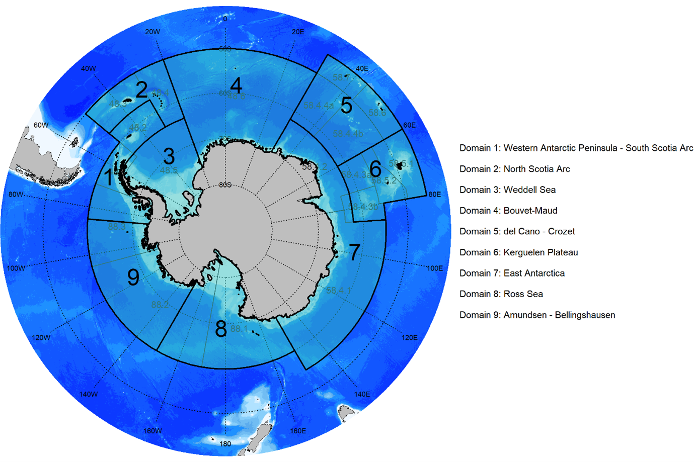
CCAMLR MPA planning domains. Source CCAMLR Geographical Information System.
The first high-seas MPA that was agreed by CCAMLR was the South Orkney Islands southern shelf MPA in 2009 in planning domain 1. The largest high-seas MPA in the world, the Ross Sea region MPA, was agreed in 2016 and came into force in 2017. Located in planning domain 8, it includes areas of total protection and some areas where limited fishing is allowed (the Krill Research Zone KRZ and Special Research Zone SRZ in the figure below). The objectives of the MPA are to conserve natural ecological structure in the Ross Sea, provide reference areas for monitoring natural variability and long-term change, promote research, conserve biodiversity, protect large-scale ecosystem processes, and protect core distributions of prey and predator species, areas of ecological importance and rare or vulnerable habitats.
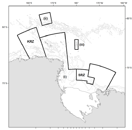
Map of the Ross Sea Region MPA. Source: Conservation Measure 91-05.
Four more high-seas MPAs are currently being considered by CCAMLR in MPA planning domains 1 (Antarctic Peninsula), 3 (Weddell Sea Phase 1), 4 (Weddell Sea Phase 2) and 7 (East Antarctica).
Details of proposed and implemented MPAs are maintained in the CCAMLR MPA Information Repository (CMIR). This website presents basic information about the history and objectives of each MPA, the baseline data used in the proposal and the area boundaries.